
Morro do Canal topographic map
Click on the map to display elevation.
About this map
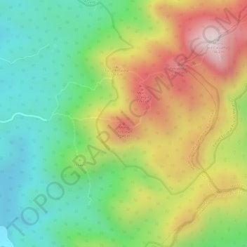
Name: Morro do Canal topographic map, elevation, terrain.
Average elevation: 3,750 ft
Minimum elevation: 2,972 ft
Maximum elevation: 4,721 ft
Other topographic maps
Click on a map to view its topography, its elevation and its terrain.
Barragem Cayuguava
Brasil > Paraná > Região Metropolitana de Curitiba > Piraquara
Average elevation: 3,005 ft
Floresta ombrófila mista
Brasil > Paraná > Região Metropolitana de Curitiba > Piraquara > Purgatório
Average elevation: 3,077 ft