Geolocate

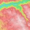
Calviac topographic map

Click on the map to display elevation.

About this map

Name: Calviac topographic map, elevation, terrain.

Location: Calviac, Sousceyrac-en-Quercy, Figeac, Lot, Occitanie, France métropolitaine, 46190, France (44.87126 2.03079 44.95185 2.10813)

Average elevation: 2,011 ft

Minimum elevation: 1,637 ft

Maximum elevation: 2,326 ft

Other topographic maps

Click on a map to view its topography, its elevation and its terrain.
La Croix de Lissarthe

France > Occitanie > Lot > Sousceyrac-en-Quercy

Average elevation: 1,831 ft

Candes

France > Occitanie > Lot > Sousceyrac-en-Quercy

Average elevation: 1,467 ft

Les Landes-Ouest

France > Occitanie > Lot > Sousceyrac-en-Quercy

Average elevation: 1,864 ft

Fontebinieyre

France > Occitanie > Lot > Sousceyrac-en-Quercy

Average elevation: 1,640 ft

Lamativie-Gare

France > Occitanie > Lot > Sousceyrac-en-Quercy

Average elevation: 1,673 ft

Lacaze

France > Occitanie > Lot > Sousceyrac-en-Quercy

Average elevation: 1,985 ft

Gear up for your next adventure:

🌧️Backpack Rain Cover - Keep gear dry in wet weather
🪑Ultralight Camp Chairs - Portable seating for resting after a long day of mapping
💧Water Purification System - Clean water on the trail with reliable purifiers
📶Satellite Messenger - Communication device off‑grid
🎁Geography Themed Gifts - Unique gift ideas for map lovers and geography enthusiasts

As an Amazon Associate, this site earns from qualifying purchases at no extra cost to you.