
Thank you for supporting this site ❤️
Make a donation
Make a donation
Gear up for your next adventure:
As an Amazon Associate, this site earns from qualifying purchases at no extra cost to you.
Mwangaza topographic map
Click on the map to display elevation.
Thank you for supporting this site ❤️
Make a donation
Make a donation
Gear up for your next adventure:
As an Amazon Associate, this site earns from qualifying purchases at no extra cost to you.
About this map
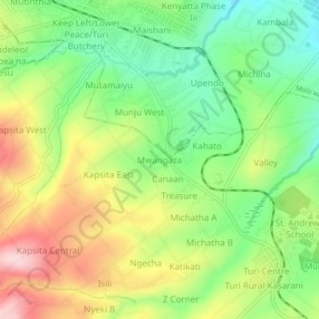
Name: Mwangaza topographic map, elevation, terrain.
Location: Mwangaza, Turi ward, Molo, Nakuru, Kenya (-0.29002 35.72414 -0.25002 35.76414)
Average elevation: 8,173 ft
Minimum elevation: 7,805 ft
Maximum elevation: 8,665 ft
Thank you for supporting this site ❤️
Make a donation
Make a donation
Gear up for your next adventure:
As an Amazon Associate, this site earns from qualifying purchases at no extra cost to you.