Geolocate

Ambato topographic map

Click on the map to display elevation.

About this map

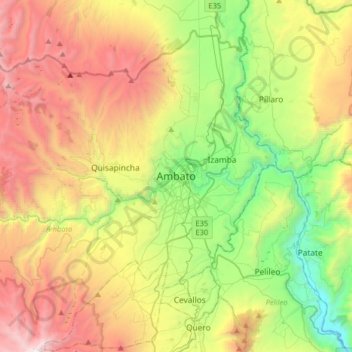
Name: Ambato topographic map, elevation, terrain.

Location: Ambato, Tungurahua, 0838, Ecuador (-1.40224 -78.78876 -1.08224 -78.46876)

Average elevation: 10,318 ft

Minimum elevation: 6,322 ft

Maximum elevation: 15,942 ft

Other topographic maps

Click on a map to view its topography, its elevation and its terrain.

Parque de la Madre

Ecuador > Tungurahua > Ambato > Ambato

Average elevation: 8,602 ft

Gear up for your next adventure:

🧢Outdoor Hiking Hat - Sun protection hat for outdoor explorers
🏥Hiking First Aid Kits - Comprehensive medical kits for remote trail injuries
🔦LED Headlamp - Bright and durable LED headlamp for night navigation
🥾Men's Hiking Boots - Durable, waterproof footwear for rugged terrain and steep inclines
🧭Map Reading Tools - Tools and kits for map navigation

As an Amazon Associate, this site earns from qualifying purchases at no extra cost to you.