Geolocate

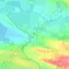
Cuiltylough topographic map

Click on the map to display elevation.

About this map

Name: Cuiltylough topographic map, elevation, terrain.

Location: Cuiltylough, Riverstown ED, Ballymote-Tubbercurry Municipal District, County Sligo, Connacht, Ireland (54.12425 -8.39502 54.13409 -8.37907)

Average elevation: 190 ft

Minimum elevation: 131 ft

Maximum elevation: 338 ft

Other topographic maps

Click on a map to view its topography, its elevation and its terrain.

Benbulbin

Ireland > County Sligo

Average elevation: 843 ft

Rathcormack

Ireland > County Sligo

Average elevation: 89 ft

Geevagh

Ireland > County Sligo

Average elevation: 302 ft

Truskmore

Ireland > County Sligo

Average elevation: 1,467 ft

Drumcliff Round Tower

Ireland > County Sligo

Average elevation: 33 ft

Rosses Point

Ireland > County Sligo

Average elevation: 13 ft

Dooney Rock

Ireland > County Sligo

Average elevation: 174 ft

Beltra

Ireland > County Sligo

Average elevation: 62 ft

Coney Island

Ireland > County Sligo

Average elevation: 3 ft

Kesh

Ireland > County Sligo

Average elevation: 400 ft

Ballynacarrow

Ireland > County Sligo

Average elevation: 236 ft

Garavogue

Ireland > County Sligo

Average elevation: 66 ft

Castlebaldwin

Ireland > County Sligo

Average elevation: 302 ft

Chapel Street

Ireland > County Sligo

Average elevation: 203 ft

Kesh

Ireland > County Sligo

Average elevation: 400 ft

Cloonloo

Ireland > County Sligo

Average elevation: 335 ft

Geevagh

Ireland > County Sligo

Average elevation: 302 ft

Easky

Ireland > County Sligo

In Samuel Lewis's 1837 publication of A Topographical Dictionary of Ireland, Easky was described as having 6,124 inhabitants, of which 289 were in the village. Lewis noted that the village (made up of one long street) had petty sessions every fortnight and that Wednesday was market day. As well as other more…

Average elevation: 56 ft

Carrane Hill

Ireland > County Sligo

Average elevation: 1,063 ft

Gear up for your next adventure:

🥾Women's Hiking Boots - Top-rated trail boots with ankle support and superior grip
📌Outdoor GPS Map App - Apps and devices for digital topographic navigation
📱Solar Portable Charger - Solar power bank for charging devices off‑grid
🔪Outdoor Multitools - Essential survival tools for gear repair and field use
📻Weather Alert Radios - Stay informed of storm risks while off-the-grid

As an Amazon Associate, this site earns from qualifying purchases at no extra cost to you.