Geolocate

Heapey topographic map

Click on the map to display elevation.

About this map

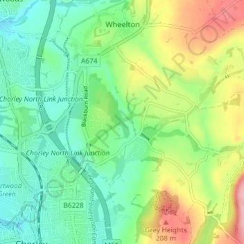
Name: Heapey topographic map, elevation, terrain.

Location: Heapey, Chorley, Lancashire, England, United Kingdom (53.65320 -2.61324 53.68907 -2.55514)

Average elevation: 417 ft

Minimum elevation: 243 ft

Maximum elevation: 755 ft

Other topographic maps

Click on a map to view its topography, its elevation and its terrain.

Whittle Springs

United Kingdom > England > Lancashire > Chorley > Wheelton

Average elevation: 364 ft

Gear up for your next adventure:

🪶Thermal Camp Blanket - Extra warmth for cold nights
🛠️Outdoor Gear Repair Kit - Essential tools to fix gear on the trail
🥤Water Filter Bottle - All‑in‑one filter bottle for safe hydration
🧺Microfiber Travel Towels - Compact and fast-drying towels for trail use
📖Nature Tracking Books - Learn to track wildlife and terrain

As an Amazon Associate, this site earns from qualifying purchases at no extra cost to you.