Geolocate

Lumingon topographic map

Click on the map to display elevation.

About this map

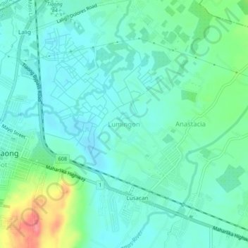
Name: Lumingon topographic map, elevation, terrain.

Location: Lumingon, Tiaong, Quezon, Calabarzon, 4325, Philippines (13.94434 121.32188 13.98434 121.36188)

Average elevation: 184 ft

Minimum elevation: 118 ft

Maximum elevation: 390 ft

Gear up for your next adventure:

❄️Traction Cleats - Prevent slips on icy trails during winter hikes
🥾Men's Hiking Boots - Durable, waterproof footwear for rugged terrain and steep inclines
🗃️Trail First Aid Kit - Essential kit for outdoor injuries and emergencies
🔥Plasma Lighters - Windproof lighters that work in any weather condition
🎒Outdoor Daypacks - Lightweight backpacks designed for carrying maps and essential gear

As an Amazon Associate, this site earns from qualifying purchases at no extra cost to you.