Geolocate

Gunupur topographic map

Click on the map to display elevation.

About this map

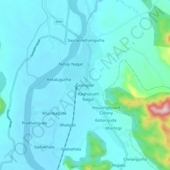
Name: Gunupur topographic map, elevation, terrain.

Location: Gunupur, Rayagada, Odisha, 765022, India (19.03140 83.77488 19.11140 83.85488)

Average elevation: 436 ft

Minimum elevation: 240 ft

Maximum elevation: 2,110 ft

Gear up for your next adventure:

🚁Photography Drones - Capture stunning aerial views of landforms and topography
🧥Waterproof Jacket for Hiking - Breathable and rugged rain jacket for outdoor excursions
👟Men's Trail Runners - Lightweight footwear for fast-paced exploration and light hiking
🏕️Tent Footprint - Protect your tent base from wear
🦺Reflective Outdoor Gear - Safety gear for low‑light conditions

As an Amazon Associate, this site earns from qualifying purchases at no extra cost to you.