
Thank you for supporting this site ❤️
Make a donation
Make a donation
Gear up for your next adventure:
As an Amazon Associate, this site earns from qualifying purchases at no extra cost to you.
Washi topographic map
Click on the map to display elevation.
Thank you for supporting this site ❤️
Make a donation
Make a donation
Gear up for your next adventure:
As an Amazon Associate, this site earns from qualifying purchases at no extra cost to you.
About this map
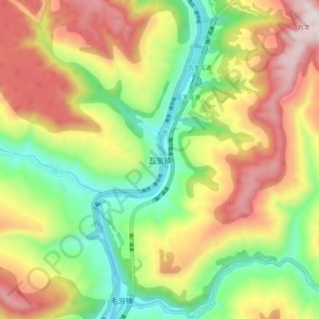
Name: Washi topographic map, elevation, terrain.
Location: Washi, Tongjiang County, Bazhong, Sichuan, China (31.96131 107.28642 32.04131 107.36642)
Average elevation: 2,369 ft
Minimum elevation: 1,086 ft
Maximum elevation: 3,950 ft
Thank you for supporting this site ❤️
Make a donation
Make a donation
Gear up for your next adventure:
As an Amazon Associate, this site earns from qualifying purchases at no extra cost to you.