
Thank you for supporting this site ❤️
Make a donation
Make a donation
Gear up for your next adventure:
As an Amazon Associate, this site earns from qualifying purchases at no extra cost to you.
Riclones topographic map
Click on the map to display elevation.
Thank you for supporting this site ❤️
Make a donation
Make a donation
Gear up for your next adventure:
As an Amazon Associate, this site earns from qualifying purchases at no extra cost to you.
About this map
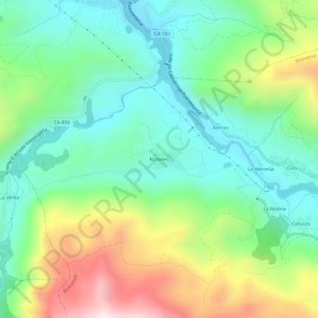
Name: Riclones topographic map, elevation, terrain.
Location: Riclones, Rionansa, Saja-Nansa, Cantabria, 39553, Spain (43.26365 -4.47774 43.30365 -4.43774)
Average elevation: 1,050 ft
Minimum elevation: 256 ft
Maximum elevation: 2,664 ft
Thank you for supporting this site ❤️
Make a donation
Make a donation
Gear up for your next adventure:
As an Amazon Associate, this site earns from qualifying purchases at no extra cost to you.