
Newton topographic map
Click on the map to display elevation.
Newton
Newton has grown around a formation of seven hills. "The general features of Newton are not without interest. Seven principal elevations mark its surface, like the seven hills of ancient Rome, with the difference that the seven hills of Newton are much more distinct than the seven hills of Rome: Nonantum Hill, Waban Hill, Chestnut Hill, Bald Pate, Oak Hill, Institution Hill and Mount Ida."
About this map
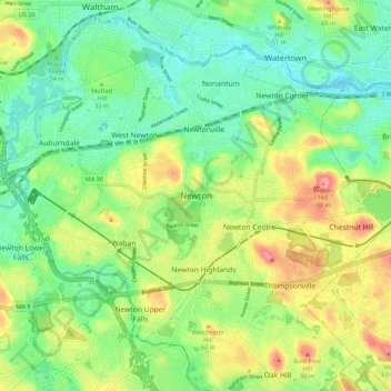
Name: Newton topographic map, elevation, terrain.
Average elevation: 141 ft
Minimum elevation: -10 ft
Maximum elevation: 610 ft
Middlesex County trails, hiking, mountain biking, running and outdoor activities
Other topographic maps
Click on a map to view its topography, its elevation and its terrain.