Geolocate

Bardstown topographic map

Click on the map to display elevation.

About this map

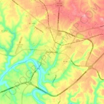
Name: Bardstown topographic map, elevation, terrain.

Location: Bardstown, Nelson County, Kentucky, 40004, United States (37.76923 -85.50690 37.84923 -85.42690)

Average elevation: 646 ft

Minimum elevation: 446 ft

Maximum elevation: 810 ft

Nelson County trails, hiking, mountain biking, running and outdoor activities

Gear up for your next adventure:

📡GPS Antenna Upgrade - Enhance GPS reception in remote terrain
Solar GPS Watches - Advanced multisport watches with built-in topographic maps
🪶Multi‑Purpose Knife - Useful blade for camp and trail
🪵Folding Camp Saw - Compact saw for wood and campsite work
🪶Wildlife Field Guides - Learn animal tracking and species ID

As an Amazon Associate, this site earns from qualifying purchases at no extra cost to you.