
Thank you for supporting this site ❤️
Make a donation
Make a donation
Gear up for your next adventure:
As an Amazon Associate, this site earns from qualifying purchases at no extra cost to you.
Winnemucca topographic map
Click on the map to display elevation.
Thank you for supporting this site ❤️
Make a donation
Make a donation
Gear up for your next adventure:
As an Amazon Associate, this site earns from qualifying purchases at no extra cost to you.
About this map
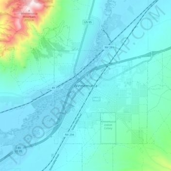
Name: Winnemucca topographic map, elevation, terrain.
Location: Winnemucca, Humboldt County, Nevada, 89445, United States (40.93243 -117.77482 41.01243 -117.69482)
Average elevation: 4,603 ft
Minimum elevation: 4,259 ft
Maximum elevation: 6,752 ft
Humboldt County trails, hiking, mountain biking, running and outdoor activities
Thank you for supporting this site ❤️
Make a donation
Make a donation
Gear up for your next adventure:
As an Amazon Associate, this site earns from qualifying purchases at no extra cost to you.