
Vale topographic map
Click on the map to display elevation.
About this map
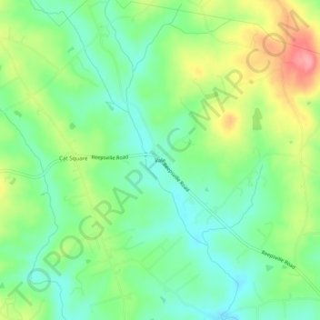
Name: Vale topographic map, elevation, terrain.
Location: Vale, Lincoln County, North Carolina, 28168, United States (35.51985 -81.41731 35.55985 -81.37731)
Average elevation: 1,007 ft
Minimum elevation: 889 ft
Maximum elevation: 1,211 ft
Lincoln County trails, hiking, mountain biking, running and outdoor activities
Other topographic maps
Click on a map to view its topography, its elevation and its terrain.