
Banaik topographic map
Interactive map
Click on the map to display elevation.
About this map
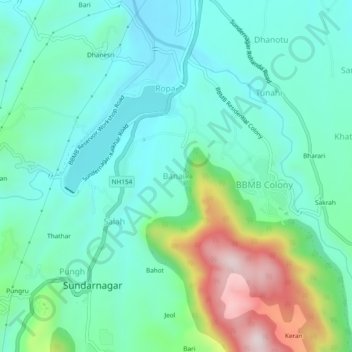
Name: Banaik topographic map, elevation, terrain.
Location: Banaik, Sundarnagar, Mandi, Himachal Pradesh, 175019, India (31.51059 76.87601 31.55059 76.91601)
Average elevation: 3,084 ft
Minimum elevation: 2,667 ft
Maximum elevation: 4,360 ft