
Thank you for supporting this site ❤️
Make a donation
Make a donation
Gear up for your next adventure:
As an Amazon Associate, this site earns from qualifying purchases at no extra cost to you.
Selci-Lama topographic map
Click on the map to display elevation.
Thank you for supporting this site ❤️
Make a donation
Make a donation
Gear up for your next adventure:
As an Amazon Associate, this site earns from qualifying purchases at no extra cost to you.
About this map
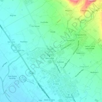
Name: Selci-Lama topographic map, elevation, terrain.
Location: Selci-Lama, San Giustino, Perugia, Umbria, 06016, Italia (43.49493 12.18120 43.53493 12.22120)
Average elevation: 1,017 ft
Minimum elevation: 928 ft
Maximum elevation: 1,345 ft
Thank you for supporting this site ❤️
Make a donation
Make a donation
Gear up for your next adventure:
As an Amazon Associate, this site earns from qualifying purchases at no extra cost to you.