
Make a donation
Gear up for your next adventure:
As an Amazon Associate, this site earns from qualifying purchases at no extra cost to you.
Wortel topographic map
Click on the map to display elevation.
Make a donation
Gear up for your next adventure:
As an Amazon Associate, this site earns from qualifying purchases at no extra cost to you.
Wortel
Wortel ligt in de Noorderkempen op een hoogte van 19-25 meter. Wortel ligt aan de bovenloop van de Mark, die stroomopwaarts haar meanderende loop heeft behouden. Ten oosten van Wortel ligt Wortel-kolonie met landbouwontginningen en bossen.
Make a donation
Gear up for your next adventure:
As an Amazon Associate, this site earns from qualifying purchases at no extra cost to you.
About this map
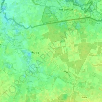
Name: Wortel topographic map, elevation, terrain.
Average elevation: 62 ft
Minimum elevation: 33 ft
Maximum elevation: 85 ft
Make a donation
Gear up for your next adventure:
As an Amazon Associate, this site earns from qualifying purchases at no extra cost to you.