
Thank you for supporting this site ❤️
Make a donation
Make a donation
Gear up for your next adventure:
As an Amazon Associate, this site earns from qualifying purchases at no extra cost to you.
Igualeja topographic map
Click on the map to display elevation.
Thank you for supporting this site ❤️
Make a donation
Make a donation
Gear up for your next adventure:
As an Amazon Associate, this site earns from qualifying purchases at no extra cost to you.
About this map
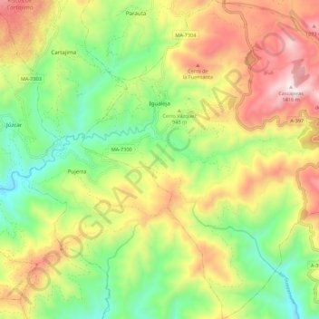
Name: Igualeja topographic map, elevation, terrain.
Location: Igualeja, Serranía de Ronda, Malaga, Andalousie, Espagne (36.57226 -5.14789 36.65960 -5.05109)
Average elevation: 2,802 ft
Minimum elevation: 1,427 ft
Maximum elevation: 4,610 ft
Thank you for supporting this site ❤️
Make a donation
Make a donation
Gear up for your next adventure:
As an Amazon Associate, this site earns from qualifying purchases at no extra cost to you.