
Thank you for supporting this site ❤️
Make a donation
Make a donation
Gear up for your next adventure:
As an Amazon Associate, this site earns from qualifying purchases at no extra cost to you.
Vene topographic map
Click on the map to display elevation.
Thank you for supporting this site ❤️
Make a donation
Make a donation
Gear up for your next adventure:
As an Amazon Associate, this site earns from qualifying purchases at no extra cost to you.
About this map
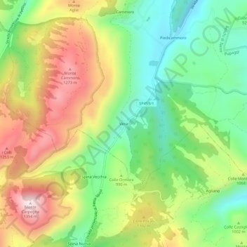
Name: Vene topographic map, elevation, terrain.
Location: Vene, Sellano, Perugia, Umbria, 06030, Italy (42.85472 12.83254 42.89472 12.87254)
Average elevation: 3,291 ft
Minimum elevation: 2,480 ft
Maximum elevation: 4,380 ft
Thank you for supporting this site ❤️
Make a donation
Make a donation
Gear up for your next adventure:
As an Amazon Associate, this site earns from qualifying purchases at no extra cost to you.