
Thank you for supporting this site ❤️
Make a donation
Make a donation
Gear up for your next adventure:
As an Amazon Associate, this site earns from qualifying purchases at no extra cost to you.
Borehole topographic map
Click on the map to display elevation.
Thank you for supporting this site ❤️
Make a donation
Make a donation
Gear up for your next adventure:
As an Amazon Associate, this site earns from qualifying purchases at no extra cost to you.
About this map
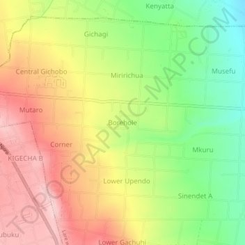
Name: Borehole topographic map, elevation, terrain.
Location: Borehole, Lare ward, Njoro, Nakuru, 20106, Kenya (-0.41401 35.96045 -0.37401 36.00045)
Average elevation: 7,070 ft
Minimum elevation: 6,693 ft
Maximum elevation: 7,431 ft
Thank you for supporting this site ❤️
Make a donation
Make a donation
Gear up for your next adventure:
As an Amazon Associate, this site earns from qualifying purchases at no extra cost to you.