Geolocate

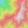
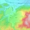
Fujieda topographic map

Click on the map to display elevation.

About this map

Name: Fujieda topographic map, elevation, terrain.

Location: Fujieda, Shizuoka Prefecture, Chubu Region, Japan (34.81581 138.15167 35.01571 138.32749)

Average elevation: 538 ft

Minimum elevation: 0 ft

Maximum elevation: 2,776 ft

Other topographic maps

Click on a map to view its topography, its elevation and its terrain.
Osaka Prefecture

Japan

Average elevation: 617 ft

300M

Japan > Nagasaki

Average elevation: 722 ft

Takeda Castle

Japan > Asago

Average elevation: 571 ft

Akaishi Mountains

Japan > Oshika

Average elevation: 8,501 ft

Iwo to

Japan > Tokyo > Ogasawara

Average elevation: 0 ft

葭町

Japan > Matsumoto

Average elevation: 2,021 ft

Nishikigaoka-chuo Park

Japan > Sendai

Average elevation: 646 ft

Nakauonuma County

Japan

Average elevation: 1,985 ft

Mount Yatsugatake viewpoint

Japan > Suwa County > Fujimi

Average elevation: 5,715 ft

Gear up for your next adventure:

🌡️Portable Weather Meter - Track weather conditions on the trail
🏔️Mountain Trail Maps - High‑detail maps for popular peaks
🔭Stargazing Telescopes - Perfect for camping in low-light pollution areas shown on maps
🔊Portable Camp Speaker - Music and alerts at camp
🧭Hiking Compass - Precision compass for reliable navigation in the wilderness

As an Amazon Associate, this site earns from qualifying purchases at no extra cost to you.