Geolocate

Nagaram topographic map

Click on the map to display elevation.

About this map

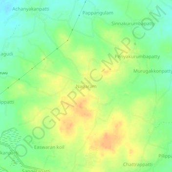
Name: Nagaram topographic map, elevation, terrain.

Location: Nagaram, Iluppur taluk, Pudukkottai, Tamil Nadu, India (10.53937 78.59190 10.57937 78.63190)

Average elevation: 440 ft

Minimum elevation: 381 ft

Maximum elevation: 495 ft

Other topographic maps

Click on a map to view its topography, its elevation and its terrain.

Sittannavasal

India > Tamil Nadu > Iluppur taluk

Average elevation: 407 ft

Gear up for your next adventure:

🗺️NatGeo Topo Maps - High-quality waterproof printed topographic maps of US Parks
📷Action Cameras - Rugged cameras to document your journeys across rugged terrain
🧥Men's Rain Shells - Premium waterproof and breathable jackets for mountain weather
🔦LED Headlamp - Bright and durable LED headlamp for night navigation
📖Nature Tracking Books - Learn to track wildlife and terrain

As an Amazon Associate, this site earns from qualifying purchases at no extra cost to you.