
Thank you for supporting this site ❤️
Make a donation
Make a donation
Gear up for your next adventure:
As an Amazon Associate, this site earns from qualifying purchases at no extra cost to you.
McGrath topographic map
Click on the map to display elevation.
Thank you for supporting this site ❤️
Make a donation
Make a donation
Gear up for your next adventure:
As an Amazon Associate, this site earns from qualifying purchases at no extra cost to you.
About this map
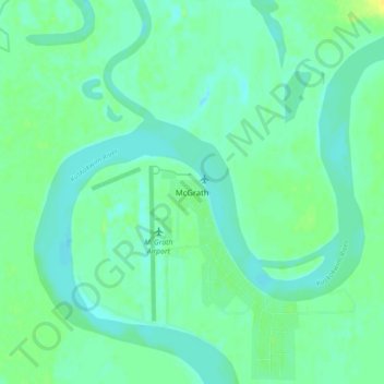
Name: McGrath topographic map, elevation, terrain.
Location: McGrath, Unorganized Borough, Alaska, 99627, United States (62.93639 -155.61583 62.97639 -155.57583)
Average elevation: 335 ft
Minimum elevation: 315 ft
Maximum elevation: 374 ft
Unorganized Borough trails, hiking, mountain biking, running and outdoor activities
Thank you for supporting this site ❤️
Make a donation
Make a donation
Gear up for your next adventure:
As an Amazon Associate, this site earns from qualifying purchases at no extra cost to you.