
Thank you for supporting this site ❤️
Make a donation
Make a donation
Gear up for your next adventure:
As an Amazon Associate, this site earns from qualifying purchases at no extra cost to you.
Akhaltsikhe topographic map
Click on the map to display elevation.
Thank you for supporting this site ❤️
Make a donation
Make a donation
Gear up for your next adventure:
As an Amazon Associate, this site earns from qualifying purchases at no extra cost to you.
About this map
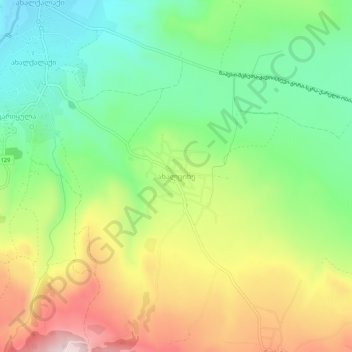
Name: Akhaltsikhe topographic map, elevation, terrain.
Location: Akhaltsikhe, Kaspi Municipality, Shida Kartli, Georgia (41.85152 44.33923 41.89152 44.37923)
Average elevation: 2,598 ft
Minimum elevation: 2,041 ft
Maximum elevation: 3,412 ft
Thank you for supporting this site ❤️
Make a donation
Make a donation
Gear up for your next adventure:
As an Amazon Associate, this site earns from qualifying purchases at no extra cost to you.