Geolocate

Picture Rocks topographic map

Click on the map to display elevation.

About this map

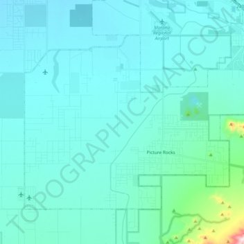
Name: Picture Rocks topographic map, elevation, terrain.

Location: Picture Rocks, Pima County, Arizona, United States (32.29157 -111.32133 32.40249 -111.13740)

Average elevation: 2,159 ft

Minimum elevation: 1,939 ft

Maximum elevation: 4,344 ft

Pima County trails, hiking, mountain biking, running and outdoor activities

Gear up for your next adventure:

📦Gear Storage Bags - Organize and protect outdoor equipment
🥾Men's Hiking Boots - Durable, waterproof footwear for rugged terrain and steep inclines
🪑Ultralight Camp Chairs - Portable seating for resting after a long day of mapping
🥾Women's Hiking Boots - Top-rated trail boots with ankle support and superior grip
📱Solar Portable Charger - Solar power bank for charging devices off‑grid

As an Amazon Associate, this site earns from qualifying purchases at no extra cost to you.