
Thank you for supporting this site ❤️
Make a donation
Make a donation
Gear up for your next adventure:
As an Amazon Associate, this site earns from qualifying purchases at no extra cost to you.
Huaytapallana topographic map
Click on the map to display elevation.
Thank you for supporting this site ❤️
Make a donation
Make a donation
Gear up for your next adventure:
As an Amazon Associate, this site earns from qualifying purchases at no extra cost to you.
About this map
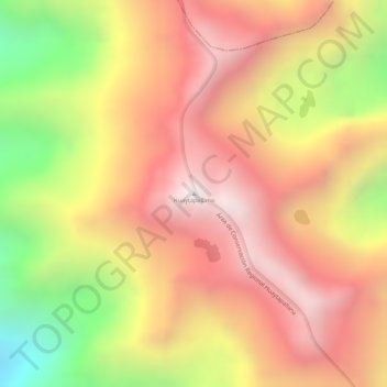
Name: Huaytapallana topographic map, elevation, terrain.
Location: Huaytapallana, Pariahuanca, Huancayo, Junín, Perú (-11.85482 -74.96965 -11.85472 -74.96955)
Average elevation: 14,780 ft
Minimum elevation: 12,746 ft
Maximum elevation: 16,047 ft
Thank you for supporting this site ❤️
Make a donation
Make a donation
Gear up for your next adventure:
As an Amazon Associate, this site earns from qualifying purchases at no extra cost to you.