
Thank you for supporting this site ❤️
Make a donation
Make a donation
Gear up for your next adventure:
As an Amazon Associate, this site earns from qualifying purchases at no extra cost to you.
Colombella topographic map
Click on the map to display elevation.
Thank you for supporting this site ❤️
Make a donation
Make a donation
Gear up for your next adventure:
As an Amazon Associate, this site earns from qualifying purchases at no extra cost to you.
About this map
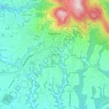
Name: Colombella topographic map, elevation, terrain.
Location: Colombella, Palestrina, Roma, Lazio, 00036, Italia (41.81129 12.87116 41.85129 12.91116)
Average elevation: 1,440 ft
Minimum elevation: 1,056 ft
Maximum elevation: 2,559 ft
Thank you for supporting this site ❤️
Make a donation
Make a donation
Gear up for your next adventure:
As an Amazon Associate, this site earns from qualifying purchases at no extra cost to you.