Geolocate

N8 topographic map

Click on the map to display elevation.

About this map

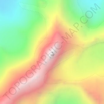
Name: N8 topographic map, elevation, terrain.

Location: N8, Marwah, Kishtwar District, Jammu and Kashmir, India (33.73484 76.11750 33.73494 76.11760)

Average elevation: 18,035 ft

Minimum elevation: 15,335 ft

Maximum elevation: 20,735 ft

Gear up for your next adventure:

🧤Tactile Hiking Gloves - Keep hands warm while operating GPS and smartphone screens
📷Action Camera - Capture your outdoor adventures in HD
🎒Waterproof Dry Bags - Keep your electronics and maps dry inside your pack
🔦Compact Flashlight - Reliable flashlight for emergencies
🌲Outdoor Survival Books - Best books on survival skills

As an Amazon Associate, this site earns from qualifying purchases at no extra cost to you.