Geolocate

Houten topographic map

Click on the map to display elevation.

About this map

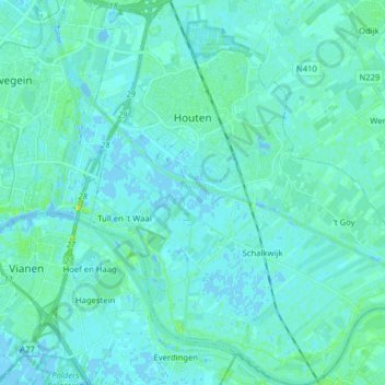
Name: Houten topographic map, elevation, terrain.

Location: Houten, Utrecht, Netherlands (51.95943 5.11956 52.05676 5.27145)

Average elevation: 10 ft

Minimum elevation: -13 ft

Maximum elevation: 52 ft

Other topographic maps

Click on a map to view its topography, its elevation and its terrain.

Palestina

Netherlands > Utrecht > Amersfoort

Average elevation: 7 ft

Breedeveen

Netherlands > Utrecht > Leersum

Average elevation: 49 ft

Cabauw

Netherlands > Utrecht

Average elevation: -3 ft

Amerongse Berg

Netherlands > Utrecht > Amerongen

Average elevation: 112 ft

Eembrugge

Netherlands > Utrecht > Baarn

Average elevation: 3 ft

Graaf

Netherlands > Utrecht > Lopik

Average elevation: 0 ft

Gear up for your next adventure:

🏥Hiking First Aid Kits - Comprehensive medical kits for remote trail injuries
🧺Microfiber Travel Towels - Compact and fast-drying towels for trail use
☀️Outdoor Sunscreen - High protection sunscreen for outdoor activities
🧴Hand Sanitizer - Keep hands clean while hiking
🛰️Handheld GPS Units - Professional satellite navigators for precise backcountry mapping

As an Amazon Associate, this site earns from qualifying purchases at no extra cost to you.