
Thank you for supporting this site ❤️
Make a donation
Make a donation
Gear up for your next adventure:
As an Amazon Associate, this site earns from qualifying purchases at no extra cost to you.
Cliza topographic map
Click on the map to display elevation.
Thank you for supporting this site ❤️
Make a donation
Make a donation
Gear up for your next adventure:
As an Amazon Associate, this site earns from qualifying purchases at no extra cost to you.
About this map
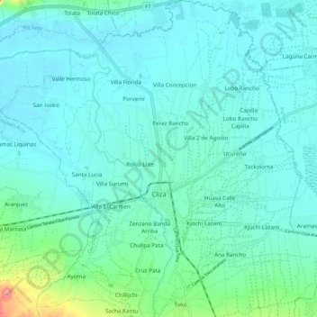
Name: Cliza topographic map, elevation, terrain.
Location: Cliza, Germán Jordán, Cochabamba, Bolivia (-17.63096 -65.98717 -17.53024 -65.88664)
Average elevation: 8,894 ft
Minimum elevation: 8,839 ft
Maximum elevation: 9,203 ft
Thank you for supporting this site ❤️
Make a donation
Make a donation
Gear up for your next adventure:
As an Amazon Associate, this site earns from qualifying purchases at no extra cost to you.