Geolocate

Hiteman topographic map

Click on the map to display elevation.

About this map

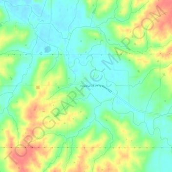
Name: Hiteman topographic map, elevation, terrain.

Location: Hiteman, Monroe County, Iowa, United States (41.03889 -92.91214 41.07889 -92.87214)

Average elevation: 837 ft

Minimum elevation: 755 ft

Maximum elevation: 958 ft

Gear up for your next adventure:

🧼Biodegradable Camping Soap - Eco‑friendly soap for outdoor hygiene
🔌USB Car Charger - Car charger for on‑the‑go power needs
🪶Paracord Bracelet - Survival bracelet with built‑in tools
🧭Outdoor Navigation Book - Learn advanced navigation skills
🧦Hiking Socks - Comfortable socks to prevent blisters on long hikes

As an Amazon Associate, this site earns from qualifying purchases at no extra cost to you.