
Thank you for supporting this site ❤️
Make a donation
Make a donation
Gear up for your next adventure:
As an Amazon Associate, this site earns from qualifying purchases at no extra cost to you.
Klimm topographic map
Click on the map to display elevation.
Thank you for supporting this site ❤️
Make a donation
Make a donation
Gear up for your next adventure:
As an Amazon Associate, this site earns from qualifying purchases at no extra cost to you.
About this map
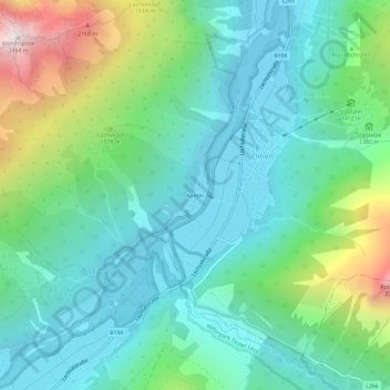
Name: Klimm topographic map, elevation, terrain.
Location: Klimm, Elmen, Bezirk Reutte, Tirol, 6644, Österreich (47.31558 10.51284 47.35558 10.55284)
Average elevation: 4,370 ft
Minimum elevation: 3,123 ft
Maximum elevation: 8,045 ft
Thank you for supporting this site ❤️
Make a donation
Make a donation
Gear up for your next adventure:
As an Amazon Associate, this site earns from qualifying purchases at no extra cost to you.