
Thank you for supporting this site ❤️
Make a donation
Make a donation
Gear up for your next adventure:
As an Amazon Associate, this site earns from qualifying purchases at no extra cost to you.
篁岭 topographic map
Click on the map to display elevation.
Thank you for supporting this site ❤️
Make a donation
Make a donation
Gear up for your next adventure:
As an Amazon Associate, this site earns from qualifying purchases at no extra cost to you.
About this map
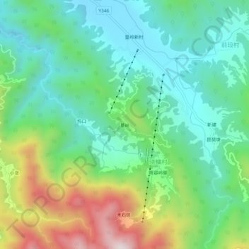
Name: 篁岭 topographic map, elevation, terrain.
Location: 篁岭, 晓鳙村, Jiangwan, Wuyuan County, Shangrao, Jiangxi, China (29.30359 118.09326 29.34359 118.13326)
Average elevation: 1,243 ft
Minimum elevation: 535 ft
Maximum elevation: 2,854 ft
Thank you for supporting this site ❤️
Make a donation
Make a donation
Gear up for your next adventure:
As an Amazon Associate, this site earns from qualifying purchases at no extra cost to you.