
Obulapuram topographic map
Interactive map
Click on the map to display elevation.
About this map
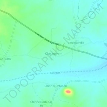
Name: Obulapuram topographic map, elevation, terrain.
Location: Obulapuram, Bathalapalle, Anantapur, Andhra Pradesh, India (14.44770 77.82736 14.48770 77.86736)
Average elevation: 1,070 ft
Minimum elevation: 1,020 ft
Maximum elevation: 1,253 ft
Other topographic maps
Click on a map to view its topography, its elevation and its terrain.
Obulapuram
India > Andhra Pradesh > Obulapuram
Obulapuram, Peddapanjani, Chittoor, Andhra Pradesh, India
Average elevation: 2,336 ft
Obulapuram
India > Andhra Pradesh > Obulapuram
Obulapuram, Prakasam, Andhra Pradesh, 523367, India
Average elevation: 906 ft