

Laguna Caldera topographic map
Click on the map to display elevation.
Laguna Caldera
Laguna Caldera is a potentially active volcanic caldera and a geographical depression in Rizal, Philippines. It is broadly elliptical in shape, with dimensions of 20 by 10 km. It has a summit (Mount Sembrano) elevation of 743 metres (2,438 ft). The caldera forms the middle lobe of Laguna de Bay, bound by the Morong Peninsula and Talim Island to the west, and the Jalajala Peninsula to the east.
About this map
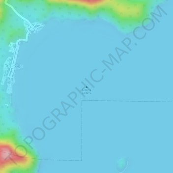
Name: Laguna Caldera topographic map, elevation, terrain.
Location: Laguna Caldera, Cardona, Rizal, Calabarzon, Philippines (14.32300 121.25260 14.32310 121.25270)
Average elevation: 46 ft
Minimum elevation: -13 ft
Maximum elevation: 627 ft