

Saïda topographic map
Click on the map to display elevation.
Saïda
Saïda is located in north-western Algeria, on the southern slopes of the Tell Atlas mountain range at the northern fringe of the High Plateaus. The city lies on the right bank of the Wadi Saïda, protected by wooded mountains on the opposite shore that rise steeply from the valley floor to an elevation of some 4,000 feet (1,200 metres).
About this map
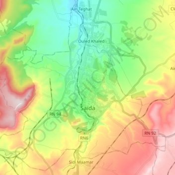
Name: Saïda topographic map, elevation, terrain.
Location: Saïda, Saïda District, Saïda, Algeria (34.78766 0.07043 34.90029 0.21446)
Average elevation: 2,972 ft
Minimum elevation: 2,293 ft
Maximum elevation: 3,937 ft