
Ryan topographic map
Click on the map to display elevation.
About this map
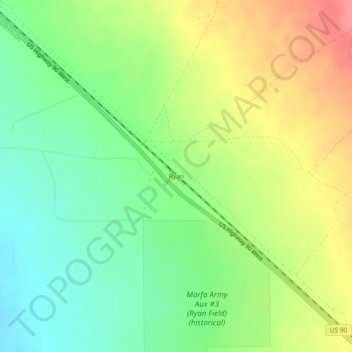
Name: Ryan topographic map, elevation, terrain.
Location: Ryan, Presidio County, Texas, United States (30.41015 -104.31880 30.45015 -104.27880)
Average elevation: 4,767 ft
Minimum elevation: 4,662 ft
Maximum elevation: 4,902 ft
Presidio County trails, hiking, mountain biking, running and outdoor activities
Other topographic maps
Click on a map to view its topography, its elevation and its terrain.
Marfa
United States > Texas > Presidio County
Marfa is a city in the high desert of the Trans-Pecos in far West Texas, United States, between the Davis Mountains and Big Bend National Park, at an elevation of 4685 feet. It is the county seat of Presidio County, and its population as of the 2020 United States Census was 1,788. The city was founded in the…
Average elevation: 4,705 ft