
Thank you for supporting this site ❤️
Make a donation
Make a donation
Gear up for your next adventure:
As an Amazon Associate, this site earns from qualifying purchases at no extra cost to you.
Doñana topographic map
Click on the map to display elevation.
Thank you for supporting this site ❤️
Make a donation
Make a donation
Gear up for your next adventure:
As an Amazon Associate, this site earns from qualifying purchases at no extra cost to you.
About this map
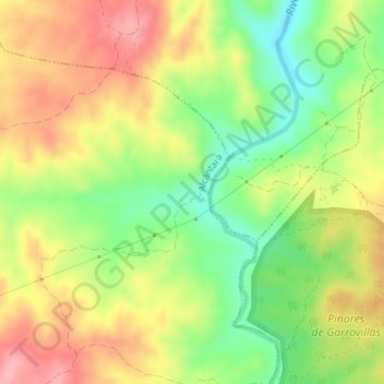
Name: Doñana topographic map, elevation, terrain.
Location: Doñana, Alcántara, Tajo-Salor, Cáceres, Extremadura, Spain (39.71472 -6.62024 39.73472 -6.60024)
Average elevation: 1,066 ft
Minimum elevation: 860 ft
Maximum elevation: 1,270 ft
Thank you for supporting this site ❤️
Make a donation
Make a donation
Gear up for your next adventure:
As an Amazon Associate, this site earns from qualifying purchases at no extra cost to you.