
Thank you for supporting this site ❤️
Make a donation
Make a donation
Gear up for your next adventure:
As an Amazon Associate, this site earns from qualifying purchases at no extra cost to you.
Besthemerberg topographic map
Click on the map to display elevation.
Thank you for supporting this site ❤️
Make a donation
Make a donation
Gear up for your next adventure:
As an Amazon Associate, this site earns from qualifying purchases at no extra cost to you.
About this map
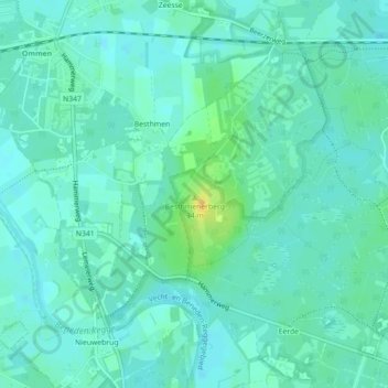
Name: Besthemerberg topographic map, elevation, terrain.
Location: Besthemerberg, Besthmen, Ommen, Overijssel, Nederland (52.49797 6.43414 52.50046 6.43641)
Average elevation: 26 ft
Minimum elevation: 7 ft
Maximum elevation: 89 ft
Thank you for supporting this site ❤️
Make a donation
Make a donation
Gear up for your next adventure:
As an Amazon Associate, this site earns from qualifying purchases at no extra cost to you.