
Omaruru topographic map
Click on the map to display elevation.
About this map
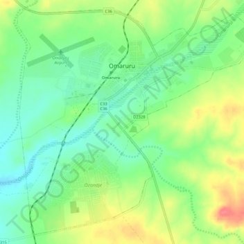
Name: Omaruru topographic map, elevation, terrain.
Location: Omaruru, Erongo Region, Namibia (-21.45083 15.92915 -21.40627 15.98086)
Average elevation: 4,009 ft
Minimum elevation: 3,921 ft
Maximum elevation: 4,134 ft
Other topographic maps
Click on a map to view its topography, its elevation and its terrain.