Geolocate

Dimbhe topographic map

Click on the map to display elevation.

About this map

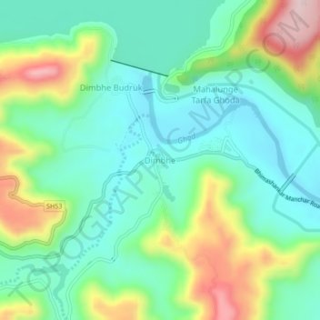
Name: Dimbhe topographic map, elevation, terrain.

Location: Dimbhe, Ambegaon, Maharashtra, India (19.06490 73.72529 19.10490 73.76529)

Average elevation: 2,477 ft

Minimum elevation: 2,126 ft

Maximum elevation: 3,268 ft

Other topographic maps

Click on a map to view its topography, its elevation and its terrain.

Shinoli

India > Maharashtra > Ambegaon

Average elevation: 2,254 ft

Dhimbhe Dam

India > Maharashtra > Ambegaon > Digad

Average elevation: 2,913 ft

Gear up for your next adventure:

💧Water Purification System - Clean water on the trail with reliable purifiers
🦺Reflective Outdoor Gear - Safety gear for low‑light conditions
Solar GPS Watches - Advanced multisport watches with built-in topographic maps
🪄Magnetic Compass - Accurate compass for navigation
🥄Camping Utensil Set - Lightweight utensils for outdoor meals

As an Amazon Associate, this site earns from qualifying purchases at no extra cost to you.