
Buk-gu topographic map
Click on the map to display elevation.
About this map
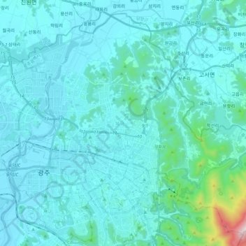
Name: Buk-gu topographic map, elevation, terrain.
Location: Buk-gu, Gwangju, South Korea (35.12109 126.83489 35.25880 127.02330)
Average elevation: 331 ft
Minimum elevation: 23 ft
Maximum elevation: 3,747 ft