
Thank you for supporting this site ❤️
Make a donation
Make a donation
Gear up for your next adventure:
As an Amazon Associate, this site earns from qualifying purchases at no extra cost to you.
Klöch topographic map
Click on the map to display elevation.
Thank you for supporting this site ❤️
Make a donation
Make a donation
Gear up for your next adventure:
As an Amazon Associate, this site earns from qualifying purchases at no extra cost to you.
About this map
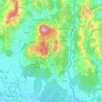
Name: Klöch topographic map, elevation, terrain.
Location: Klöch, Bezirk Südoststeiermark, Styria, 8493, Austria (46.72776 15.93531 46.80602 15.99404)
Average elevation: 922 ft
Minimum elevation: 712 ft
Maximum elevation: 1,519 ft
Thank you for supporting this site ❤️
Make a donation
Make a donation
Gear up for your next adventure:
As an Amazon Associate, this site earns from qualifying purchases at no extra cost to you.