
Thank you for supporting this site ❤️
Make a donation
Make a donation
Gear up for your next adventure:
As an Amazon Associate, this site earns from qualifying purchases at no extra cost to you.
Jumbilla topographic map
Click on the map to display elevation.
Thank you for supporting this site ❤️
Make a donation
Make a donation
Gear up for your next adventure:
As an Amazon Associate, this site earns from qualifying purchases at no extra cost to you.
About this map
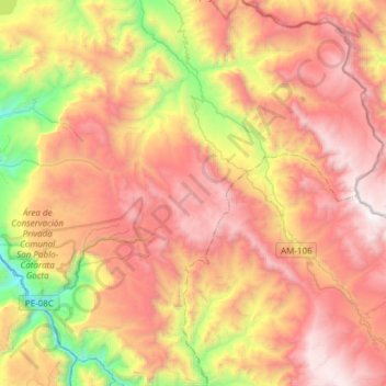
Name: Jumbilla topographic map, elevation, terrain.
Location: Jumbilla, Bongará, Amazonas, Peru (-6.12391 -77.87877 -5.82357 -77.77210)
Average elevation: 8,698 ft
Minimum elevation: 4,583 ft
Maximum elevation: 12,211 ft
Thank you for supporting this site ❤️
Make a donation
Make a donation
Gear up for your next adventure:
As an Amazon Associate, this site earns from qualifying purchases at no extra cost to you.