Geolocate

Rechnitz topographic map

Click on the map to display elevation.

About this map

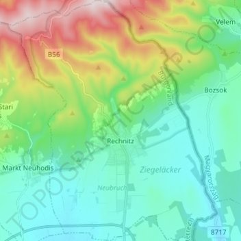
Name: Rechnitz topographic map, elevation, terrain.

Location: Rechnitz, Bezirk Oberwart, Burgenland, 7471, Austria (47.27086 16.38423 47.35292 16.48942)

Average elevation: 1,388 ft

Minimum elevation: 846 ft

Maximum elevation: 2,867 ft

Gear up for your next adventure:

🛡️Insect Repellent - Protection against bugs during outdoor activities
📱Heavy-Duty Phone Cases - Drop-proof and waterproof protection for outdoor navigation
🕶️GPS Smartphone Mount - Secure mount for phone navigation
📖Nature Tracking Books - Learn to track wildlife and terrain
🪶Multi‑Purpose Knife - Useful blade for camp and trail

As an Amazon Associate, this site earns from qualifying purchases at no extra cost to you.