
Thank you for supporting this site ❤️
Make a donation
Make a donation
Gear up for your next adventure:
As an Amazon Associate, this site earns from qualifying purchases at no extra cost to you.
Comuneglia topographic map
Click on the map to display elevation.
Thank you for supporting this site ❤️
Make a donation
Make a donation
Gear up for your next adventure:
As an Amazon Associate, this site earns from qualifying purchases at no extra cost to you.
About this map
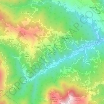
Name: Comuneglia topographic map, elevation, terrain.
Location: Comuneglia, Varese Ligure, La Spezia, Liguria, Italia (44.36437 9.49915 44.40437 9.53915)
Average elevation: 2,241 ft
Minimum elevation: 1,371 ft
Maximum elevation: 3,711 ft
Thank you for supporting this site ❤️
Make a donation
Make a donation
Gear up for your next adventure:
As an Amazon Associate, this site earns from qualifying purchases at no extra cost to you.