Geolocate

Guayle topographic map

Click on the map to display elevation.

About this map
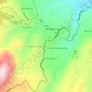
Name: Guayle topographic map, elevation, terrain.

Location: Guayle, Saraguro, Cantón Saraguro, Loja, 111150, Ecuador (-3.65002 -79.26087 -3.61002 -79.22087)

Average elevation: 8,698 ft

Minimum elevation: 7,287 ft

Maximum elevation: 10,801 ft

Gear up for your next adventure:

🧭Outdoor Navigation Book - Learn advanced navigation skills
🔪Outdoor Multitools - Essential survival tools for gear repair and field use
🌐World Map Poster - Decorative world maps with topographic info
🪶Compact Camp Shovel - Folding shovel for campsite tasks
🛰️Handheld GPS Units - Professional satellite navigators for precise backcountry mapping

As an Amazon Associate, this site earns from qualifying purchases at no extra cost to you.