
Make a donation
Gear up for your next adventure:
As an Amazon Associate, this site earns from qualifying purchases at no extra cost to you.
Cammarata topographic map
Click on the map to display elevation.
Make a donation
Gear up for your next adventure:
As an Amazon Associate, this site earns from qualifying purchases at no extra cost to you.
Cammarata
Cammarata is a comune (municipality) in the Province of Agrigento in the Italian region Sicily, located about 60 kilometres (37 mi) southeast of Palermo and about 35 kilometres (22 mi) north of Agrigento on the eponymous mountain, which has an elevation 1,578 metres (5,177 ft) above sea level in a territory rich in forests.
Make a donation
Gear up for your next adventure:
As an Amazon Associate, this site earns from qualifying purchases at no extra cost to you.
About this map
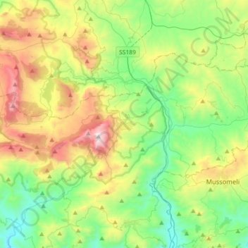
Name: Cammarata topographic map, elevation, terrain.
Location: Cammarata, Agrigento, Sicily, 92022, Italy (37.56550 13.54619 37.69501 13.83136)
Average elevation: 1,962 ft
Minimum elevation: 394 ft
Maximum elevation: 5,125 ft
Make a donation
Gear up for your next adventure:
As an Amazon Associate, this site earns from qualifying purchases at no extra cost to you.