
Sakesar topographic map
Click on the map to display elevation.
About this map
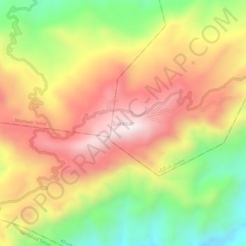
Name: Sakesar topographic map, elevation, terrain.
Location: Sakesar, Tala Gang Tehsil, Punjab, Pakistan (32.52328 71.91277 32.56328 71.95277)
Average elevation: 3,688 ft
Minimum elevation: 2,257 ft
Maximum elevation: 4,977 ft