Geolocate

Engensen topographic map

Click on the map to display elevation.

About this map

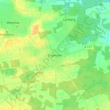
Name: Engensen topographic map, elevation, terrain.

Location: Engensen, Burgwedel, Region Hannover, Niedersachsen, Deutschland (52.48030 9.92428 52.52030 9.96428)

Average elevation: 187 ft

Minimum elevation: 141 ft

Maximum elevation: 233 ft

Gear up for your next adventure:

🧯Portable Fire Pit - Compact fire pit for camping spots
🧯Emergency Survival Kit - All‑in‑one survival essentials for the backcountry
🧭GPS Watch Accessories - Bands and chargers for GPS watches
🧦Merino Wool Socks - Moisture-wicking, blister-preventing socks for long treks
🧢Sun Protection Hats - Wide-brimmed and UPF-rated hats for high-altitude sun safety

As an Amazon Associate, this site earns from qualifying purchases at no extra cost to you.